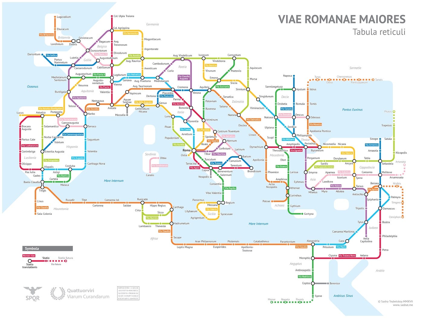
Recently, a new transit map of Ancient Rome came to light. Check out University of Chicago student Alexandr Trubetskoy’s ridiculously awesome transit map of Ancient Roman roads.
For geeks who love transit and subways and who also love ancient stuff, it’s cool. Could the Vandals have optimized their invasion of North Africa by researching the Via Claudia route ahead of time on such a map? It may even have helped with exiles – just throw them wherever the roads aren’t. For our part, we’ve published before how Roman city life 2,000 years ago was a distinctly mixed use phenomenon.
Connecting Transit Maps to Pedestrian and Bicycle Paths
But the map calls to mind ways our modern transportation systems can integrate transit into other aspects of our transportation system, such as pedestrian walkways, bicycle-friendly routes, and retail and commercial locations. We’ve covered some of these topics in our own infographics:
 Infographic – The Appeal of Transit-Oriented Development: As you can see from our recently published infographic on transit oriented development, developers (not to mention tenants and commuters) are recognizing the appeal of transit-oriented development. TOD brings together residential, retail, business, and leisure space within walking distance of public transportation.
 Infographic – WMATA Metrorail Walking + Biking Map: Elsewhere, last year we released a walking/biking version of the Washington, DC Metrorail map, bringing to light areas between train stations that are walkable or bikable, and even showing how many calories people can burn by choosing the self-propelled route for part of their commute.
Of further use could be a map that showed the connections between Metrorail, bikeshare locations, and bicycle paths such as the W&OD Trail, which stretches for 30 miles west from Arlington to Leesburg, Virginia. For example, a couple years ago our traffic engineering team participated in a project to connect new local bike lanes in Leesburg to the W&OD “bicycle superhighway.” We think the ancient Romans would have approved.


